The loss of the popular Julians Berry Farm and Café has come a step closer although it will likely take up to four years before houses start popping up where strawberries now grow.
Whakatāne District Council’s environment, energy and resilience committee met yesterday and approved public notification of a proposed change to its District Plan to allow for the farm, and adjoining property, to be zoned residential.
A small area will be changed to an urban living zone to allow for medium-density residential.
The proposed Plan Change 8 will rezone about 15 hectares of land on Huna Road to provide capacity for 150 to 175 house sites.
The rezoned land includes the 10ha Julians Berry Farm at 12 Huna Road, which is already zoned deferred residential, and an adjoining 5ha to the north, owned by the Kawarehe Trust, which wishes to build papakāinga housing.
The Kawarehe Trust land is currently zoned as rural plains.
Policy, planning and consents compliance manager Nicholas Woodley said the council had been approached by the owners of the berry farm about two years ago as they were ready to start developing the land for housing.
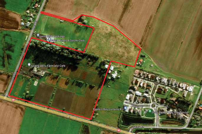 The red line shows the area to be rezoned as residential, which includes three properties, Julians Berry Farm, land to the north owned by Kawarehe Trust and a property to the east at 234a State Highway 30. Land between this area and the Shaw Road subdivision is already zoned as residential. Image supplied,
Since that time the council has been working with them, and a neighbouring property to the east at 234a State Highway 30, to enable development, which will be integrated with the housing already developed at Shaw Road.
The property between the berry farm and the Shaw Road development is already zoned residential.
During consultation with neighbouring landowners, Kawarehe Trust, which owns land behind the Paroa Rugby and Sports Club at 30a Huna Road, indicated they would like some of the club's land, located on a elevated dune ridge behind the sports club, to be included in the proposed plan change.
Their planned papakāinga development is intended to connect to council infrastructure such as water supply, waste water and roading.
Mr Woodley said Whakatāne had experienced high growth over the past few years and the council was required under the National Policy Statement for Urban Development to ensure it was making more development capacity available.
“This gets us part of the way there."
He noted that recent research undertaken for the Eastern Bay Spatial Plan estimated that more than 1500 dwellings would be required by 2033.
Notification of the proposed plan change will be included in rate mail outs in February and by advertising. Once it has been notified, it will be opened for submissions.
Councillor Wilson James asked what the time frame was for the plan change.
Mr Woodley said he expected it to take about two years, depending on the number of submissions and whether it went through to a hearing.
Following the plan change becoming operative, the developers would need to apply for resource consent for their development. Depending on how quickly that process went, it could be a year or two.
“So, from today until putting a peg in the ground for houses to go up, it could be three to four years.”
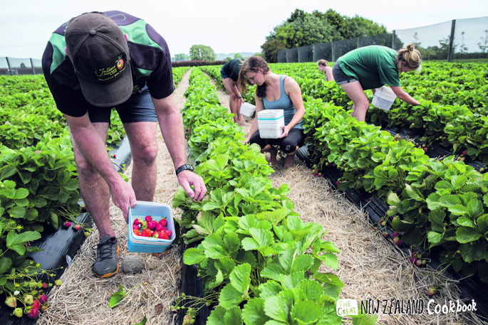
 Julians Berry Farm sign. Beacon file photo.
Councillor Nandor Tanczos said it was “sad to see us losing Julians Berry Farm”.
“It’s such a great community asset, but it is deferred residential, and we do need more housing.
“I’m pleased to see the papakāinga using this opportunity to rezone as well.”
“You can’t have your house and your strawberry, too,” Mayor Victor Luca said.
Public Interest Journalism funded through NZ On Air.
![]()

0 comments
Leave a Comment
You must be logged in to make a comment.