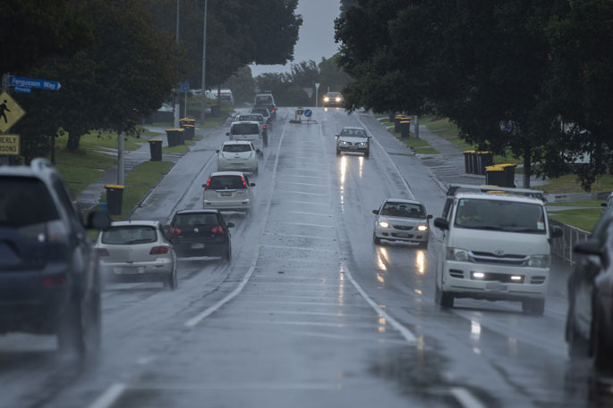
MetService has issued a severe weather warning, with heavy rain, severe gales and heavy snow expected for parts of the country.
In addition, MetService has issued a heavy rain watch for Bay of Plenty east of Whakatane. This watch is valid for eight hours until 5pm on Sunday.
Periods of heavy rain with thunderstorms are expected at times in the Bay of Plenty, and rainfall amounts may approach warning criteria. Another period of heavy rain is likely in this region during Monday morning.
MetService has issued a road snow warning for Desert Road, which is valid for eight hours from 4am Monday to midday Monday. A period of snow is likely during Monday morning and 1 - 3 cm of snow may settle on the summit of Desert Road.
A strong unsettled west to northwest flow lies over New Zealand, with several embedded troughs and frontal features bringing heavy rain, strong winds and snow to parts of the country.
The flow should change to strong southwesterly from the south during Monday. Severe weather warnings and watches remain in force for many areas.
In addition, severe thunderstorms are possible for some areas.
People are advised to keep up to date with the latest forecasts in case any changes are made.
Area: North Taranaki and Taihape, the west of Taupo, Taumarunui and Waitomo
Valid: 21 hours from 9:00 am Sunday to 6:00 am Monday
Forecast: Periods of heavy rain with thunderstorms at times. Rainfall amounts may approach warning criteria.
Area: Horowhenua to Wellington north of Johnsonville
Valid: 36 hours from 9:00 am Sunday to 9:00 pm Monday
Forecast: Periods of heavy rain with thunderstorms at times. Rainfall amounts may approach warning criteria.
Area: Westland from Otira northwards and Buller
Valid: 32 hours from 9:00 am Sunday to 5:00 pm Monday
Forecast: Periods of heavy rain with thunderstorms. Rainfall amounts may approach warning criteria, mainly about the ranges. Freezing level about 1700 metres at first, lowering to about 1300 metres this evening.
Area: The headwaters of Canterbury lakes and rivers
Valid: 27 hours from 9:00 am Sunday to 12:00 pm Monday
Forecast: Periods of heavy rain with thunderstorms at times. Rainfall amounts may approach warning criteria within 20 km east of the main divide. Freezing level lowering to about 1200 metres this afternoon. Much of this precipitation is likely to fall as snow above 1000 metres.
Heavy snow watch
MetService has issued a heavy snow watch for the Queenstown Lakes District and the Canterbury High Country west of Otematata and about and south of Mount Cook Village. This is valid for six hours from 9am to 3pm on Sunday. Snow may lower to 400 metres for a time. Heavy snow is possible above 700 metres, and amounts may approach warning criteria.
Strong wind watch
MetService has issued a strong wind watch for the following regions:
Area: Taranaki to Kapiti, Taihape, Gisborne, Hawkes Bay and Wairarapa north of about Featherston
Valid: 29 hours from 6:00 pm Sunday to 11:00 pm Monday
Forecast: Northwest winds may approach severe gale in exposed places at times.
Area: Canterbury Plains including Christchurch and Banks Peninsula, and coastal parts of Otago
Valid: 29 hours from 9:00 am Sunday to 2:00 pm Monday
Forecast: North to northwest winds may approach severe gale in exposed places.
Area: Coastal Otago
Valid: 7 hours from 2:00 pm to 9:00 pm Monday
Forecast: Southwest winds may approach severe gale in exposed places.
Area: Southern Fiordland and coastal Southland including Stewart Island
Valid: 4 hours from 1:00 pm to 5:00 pm Monday
Forecast: Southwest winds may approach severe gale in exposed places.

0 comments
Leave a Comment
You must be logged in to make a comment.