Satellite images from the European Space Agency are being used to diagnose the health of Bay of Plenty lakes, researchers using images from space to hunt out algal blooms and help manage them.
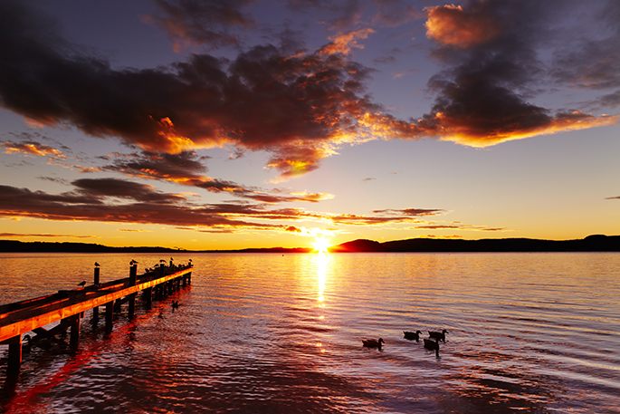
As we head into summer, which is peak algal bloom time, the health of New Zealand lakes is usually monitored by water samples taken at specific points from the lakes being tested.
Now a collaborative study by New Zealand and German researchers has shown how satellite images can be used to track algal blooms in lakes over time.
The blooms are seen from space as patches and swirls of green and brown colours.
Satellite images can support the ground management of the lakes by sending council staff to the perfect locations for water sampling.
'Using satellite imagery, we can pinpoint exactly where the blooms are and how they are spreading over time. This helps to ensure we get the best water samples, building a full picture of how healthy our lakes are, or not,” says Dr Moritz Lehmann from the Xerra Earth Observation Institute and the University of Waikato.
 Moritz Lehmann. Supplied images.
Moritz says New Zealand and Rotorua had both some of the most pristine lakes in the world and some of the most degraded but detailed data on the water quality of all New Zealand's lakes was patchy at best.
'A 2019 report from the Parliamentary Commissioner for the Environment said New Zealand was lacking in environmental monitoring data, including the water quality of most of our lakes. We tend to focus on our big ones, the ones people live closest to, or the ones that are most polluted, but we don't have a full picture.”
With satellites flying over New Zealand constantly and access to the images from the European Space Agency provided free, the methods developed on the Rotorua lakes have potential to help manage the health of all New Zealand's lakes and lakes worldwide.
This project was started by Eike Schütt, a student enrolled at the University of Kiel in Germany who wanted data to support his coursework.
 Eike Schutt.
'The Rotorua lakes boast some of the best water quality monitoring data sets in the world, so I sent Eike a decade of data from the Bay of Plenty Regional Council,” says Moritz.
With the support of Dr Martin Hieronymi and Dr Hajo Krasemann (Helmholtz-Zentrum Hereon, Germany), Eike calibrated an algorithm to detect algae in the Rotorua lakes with better accuracy than before.
The team then wanted to demonstrate how satellites can be used in routine monitoring of lake health, so they teamed up with James Dare, environmental scientist at the Bay of Plenty Regional Council.
Over time the satellite maps show chlorophyll a concentration, (chlorophyll a is an indicator of algal biomass) and the team was able to describe these patches using statistics, says Moritz.
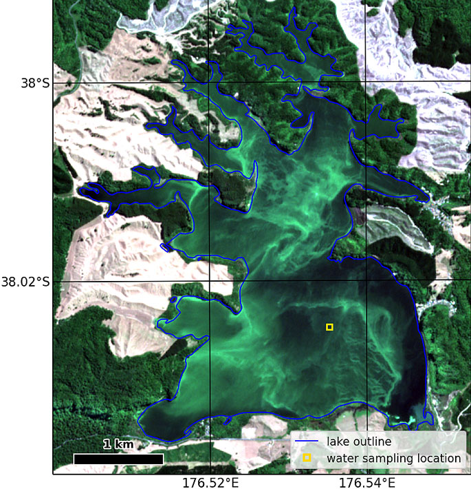
'This allows lake managers to understand how algae is distributed through the lakes without having to visit them and provides information on where the best monitoring sites are to test water quality.”
The collaborative work through this study and a recently awarded MBIE Smart Ideas project, will support further developments of the methodology.
The study was published on September 22, 2021, in the International Journal of Applied Earth Observation and Geoinformation and the article is free to download from https://doi.org/10.1016/j.jag.2021.102547

0 comments
Leave a Comment
You must be logged in to make a comment.