
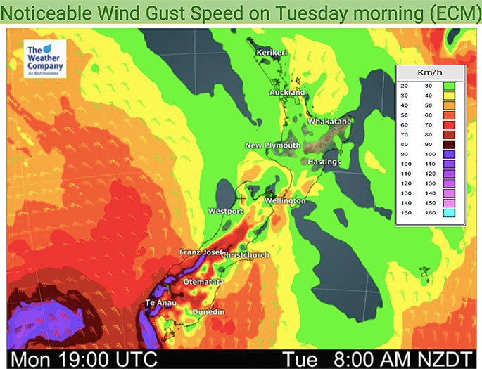
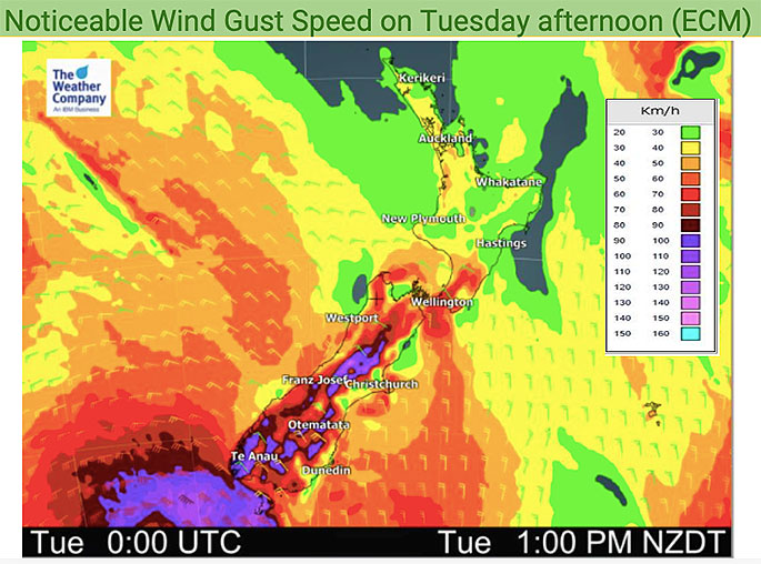
West to north west winds will gust over 120km/h in some exposed parts of New Zealand on Tuesday, pushing temperatures up above average once again in every part of New Zealand.
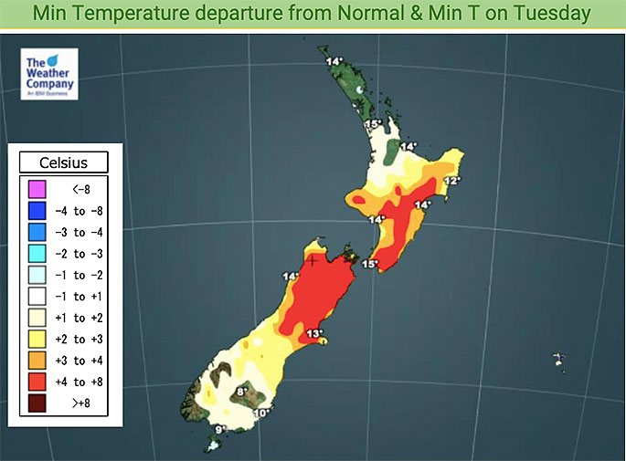
It's possible parts of Canterbury will reach heatwave criteria on Tuesday after four days with temperatures several degrees above normal, says WeatherWatch.co.nz
"A heatwave is defined as 5 days or more with maximum temperatures 5 degrees or more above normal and Tuesday sees some areas a couple degrees above normal and other parts 4 to 8 degrees above average.
"Other parts of the South Island will again be over 8 degrees above normal - before a cool down comes later on Tuesday and into Wednesday."
WeatherWatch says winds will pick up in Wellington and Cook Strait across the day (Wellington has had a number of windy days lately) but peak winds will be through the Southern Alps and surrounding ranges across the day.
"The windy weather is a typical spring set up with high pressure to the north of NZ and a low just to our south - putting the squash zone of air pressure smack bang over the South Island and lower North Island."

0 comments
Leave a Comment
You must be logged in to make a comment.